


Steve Parrish Recorded Continuing Education Library
WFPS has captured over 18 hours of webinars with respected speaker Steve Parrish. The webinars are available to purchase as a full library or as individual modules.
For those that require certificate of completion for continuing education, exams are available. Please check with your state licensing board to confirm that continuing education credit for self-study webinars. Note: Links to courses are sent separately by email after order is processed. Please allow 72 hours for delivery of links. Links expire December 31, 2026.

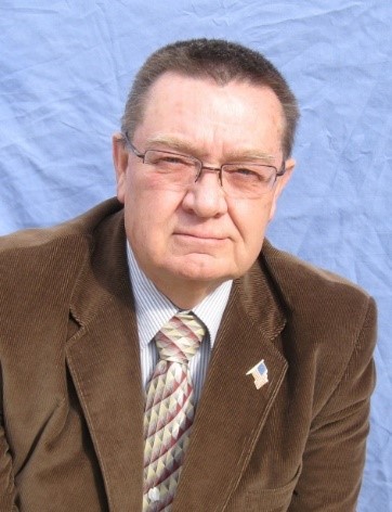 About the Speaker: John "Steve" Parrish, PLS
Steve began surveying with the U.S. Forest Service in 1963, was first licensed in Utah in 1973, and worked for the USFS through 1984. He joined the BLM in 1985, was the BLM Nevada Cadastral Chief (1989-1995), and retired from federal service in 1995. Steve is licensed in CA, ID, NV, & UT. He is semi-retired and now lives in Idaho Falls, ID. Steve shares his 60 years of land surveying knowledge & experience through occasional workshops and continuing education modules. He completed a Bachelor of Applied Science degree in 2009. Steve enjoys traveling with his family, photography, & fishing.
“5” Acre Deed & Stoddard-Jacobsen IBLA Cases (2 Hours)
Abstract:
In 1871 J.R. Johnson deeded “five acres” to Fred Banning for “Ten Dollars.” The Washoe Tribe acquired the “five acres” deed about 1940. The physical location of the “five acres” deed precipitated litigation between the Washoe Tribe and Carson Valley Golf Course about 1997. The first 35 slides of this course provide the differing opinions between the litigant’s land surveyors, and the depth of research involved.
A rancher, who had a lot of land holdings in western Nevada, hired a local land surveyor to divide some of his mountain property into saleable parcels. The surveyor subdivided Sec. 9 of T. 11 N., R. 21 E., MDM, Douglas County, Nevada. He surveyed and monumented Parcels A through H, prepared two Records of Survey, and recorded them in 1965 and 1966. Several years after the parcels had been sold, and residences built, the owner of Parcel H was informed that most of his Parcel was located on federal land. This was the beginning of a somewhat complicated boundary dispute involving the BLM, other landowners in the area, the IBLA, the private land surveyor, a mining company, a local district court, and the Nevada Supreme Court. A lot of actual documents are included in this course for those who want to read and learn more about the details and challenges that were encountered.
The Public Lands Surveying System (PLSS) (1 Hour)
Abstract: The Public Land Survey System (PLSS) was designed for simplicity in 1785 and did not anticipate the complexity involved in monumenting the PLSS plan “on the ground.” This introductory course provides a peek into a few of the challenges contracted surveyors general met with crews, terrain, equipment, and the dangers in nature.
Retracement of partial township surveys, dependent resurveys, and “walking in the footsteps” of multiple contract PLSS surveyors will reveal the endless “shortcuts” that many of the pre-1909 contract surveyors applied on a regular basis. A thorough search for original corner evidence is an integral part of a land surveyors responsibility.
A 13-Year Boundary Dispute (2 Hours)
Abstract:
T. 17 S., R. 7 E., San Bernardino Meridian, CA, was surveyed by GLO Deputy Surveyor, A.P. Hanson and approved September 6, 1880. The resultant government plat and field notes are typical for the era – 25 nice square sections containing 640 square acres and 11 lotted sections containing 640 square acres, MORE OR LESS. Soon after, settlers began buying portions of the government sections and receiving patents from the federal government. In 1916, GLO surveyors Underhill and Wright, were assigned to retrace the western tier of sections in our subject T. 17 S., R. 7 E. The 1916 retracement revealed significant closure problems with A.P. Hanson’s 1880 survey. In 1921, GLO surveyors Utterback, Wright, Warboys, and Brown were assigned to Dependently-Independently resurvey the west tier of sections in T. 17 S., R. 7 E., and all of T. 17 S., R. 6 E., with Tract Segregations to protect the rights of the patentees.
The local BLM District was seeing an increased recreational use of the BLM lands in the subject township and requested a dependent resurvey of several sections to identify the boundary lines between federal and private lands. In 1971, BLM Cadastral Surveyors Cazier and Jepson were assigned to dependently resurvey several sections in the northwestern portion of T. 17 S., R. 7 E. In 1975 a local landowner disagreed with the BLM’s location of the east line of section 9 and hired a land surveyor to investigate the BLM survey. When the private landowner realized that section 9 was almost 5 chains (330 feet) short, east to west, he began the first steps towards litigation. This course walks you through the salient points of the 13-Year Boundary Case.
Corner Site Investigation - CSI (2.5 Hours)
Course Objectives:
- To provide insight into the collection, analysis, documentation, and presentation of survey evidence for potential court challenges.
- To stress the importance of a thorough search for pertinent survey documents – recorded and unrecorded.
- To stress the importance of a thorough examination of the survey site, effects of natural and artificial disturbances to said site, and detailed documentation of field evidence and conditions.
- To encourage the sharing of survey information.
- To stress the necessity for adequate “Responsible Charge” of professional surveying activities.
- To recognize our role in the “Mentoring” process – to be a constant student (of surveying) and a respected teacher of surveying.
Walking in the Footsteps (of previous surveyors) (1.5 Hours)
Abstract: We frequently use the saying “walking in the footsteps of the original surveyor” with reference to our professional responsibilities as land surveyors. An inference is made that this saying only applies to the footsteps of the “original” government surveyors. We accept the idea that we must look thoroughly for evidence of the “original” survey but often fall short when looking for evidence of “all surveys” subsequent to the original survey.
Our challenge is further complicated by the existence of so many different types of surveys (each with subtle differences). Examples are: pre 1785 metes & bounds, post 1785 rectangular, mineral surveys, homestead entry surveys, ranchos, land grants, exchange surveys, donation land claims, reservations, parcel maps, records of survey, ALTA surveys, administrative (State. County, City boundaries), and a myriad of related surveys.
To be successful, a surveyor must understand boundary law, proportionate measurement, error analysis, deed interpretation, description writing, evidence analysis, survey history, retracement techniques, and numerous related surveying and mapping skills. Equally important is the ability to communicate effectively – orally and in writing.
During this course, a variety of challenging situations are presented. Conflicting evidence and multiple monuments are frequently encountered.
Double Monumentation – Physical and Inferred (Porcupine Corners – Our Common Problem) (1.5 Hours)
Abstract:
“My monument is better than yours.” We seldom actually verbalize this thought, but it is frequently inferred in varying ways. The task of determining which (if any) of two or more existing monuments will be accepted, as the single corner point, is a major task associated with most urban boundary surveys.
Project costs are seldom estimated on the basis of the depth of research required to verify the pedigree of existing monuments and records. The act of calling for a corner position, a mere 2 to 4 hundredths of a foot from an existing monument, verges on insanity. In actuality it is near impossible to duplicate even our own angular and distance measurements on a consistent basis. Principles, rather than math, should govern our decisions. This course will highlight a variety of “real” double (or more) conflicting monument situations.
“Ask Yourself.” Why are there two or more monuments in close proximity? Can you determine the pedigree of each monument? Have you researched the situation thoroughly?
“Possible Reasons for Multiple Monuments.” The Data Base (Basis of Bearings); Grid to Ground Conversions; An Issue Between the Original vs. the Deed Description; Crustal Movement; Date and Equipment Used; Are YOU Micromanaging YOUR Measurements?
“Acceptable Procedures.” Proportioning vs. Testimony vs. Collateral Evidence; Ties to Pertinent Nearby Monuments; Longevity (Long Time Usage); Junior/Senior Rights.
“The Takeaway.” Why two monuments may lead to litigation; Why adequate research is essential; You may not always be right.
Homestead Entry Surveys (2 Hours)
A Homestead Entry Survey (HES) begins with a U.S. Forest Service Listing Survey. These Listing Survey records are in the National Archives
Record Group No. 49, GLO: Div. ”E” (Surveying), Forest Homestead Entries. The Act of 6/11/1906 contains the provisions of the HES survey. The Listing process is conducted, requiring the (Agricultural) Secretary’s approval (Listing’s before March 1909 were surveyed by the GLO and afterwards by Forest Service personnel).
Listings were posted for 60 days and published for 30 days. After 60 days the claimant could apply to the Land Office for an Entry No. Assignment. The Land Office would give the entryman 5 years to “proof-up” his claim (prove he could make a living off his claim growing crops, building, and living in a cabin). The GLO writes Special Instructions and assigns a surveyor (usually an FS employee). The HES survey is not to exceed 160 acres of agricultural/forested land – but can be any smaller number of acres. Survey must be approved, and notes and plat produced. After final Forest Service approval a patent is issued by the General Land Office (GLO).
IBLA Case Studies (2 Hours)
A Homestead Entry is generally any Homestead claim made under the Homestead Act, as amended. Unless special authorization was granted by Congress, the land claimed must be described in conformance with the rectangular system (aka Public Land Survey System). For example, the southwest quarter of Section 5, NE1/4, and West Half, etc. Homestead claims were generally not surveyed individually, but the most recent official cadastral survey preceding the patent date was incorporated into the description of the patent by reference.
A Homestead Entry Survey is a survey of a Homestead claim made under the Act of June 11, 1906, as amended (34 Stat. 233). Since these claims “were generally rectangle, sometimes without regard to the lines of the public surveys, usually made by employees of the Forest Service under special instructions issued by the grazing and or agricultural land” (Section 10-58, Manual of Surveying Instructions, 2009). The existence of a Homestead Entry Survey should be noted in the land description on the patent by a Homestead Entry Survey number ### (may be abbreviated H.E. Survey No. ###, H.E.S. No. ###, or similar).

Mineral Surveys (4 Hours)
This course is approved and may be used for two credit hours of CFedS continuing educaiton. Additional fee for CFedS credit is $100 and when paid the exam will be opened in your CFedS portal. If interested in adding CFedS credit to this registration, please email admin@wfps.org.
General Background: Lode Claims, Placer Claims Mill sites, & Tunnels
The 1866 Mining Law primarily addressed the rights of mining claim owners to continue access to their claim(s) even if later patents blocked their direct access to their claims. SEC. 8. And be it further enacted, that the right of way for the construction of highways over public lands, not reserved for public uses, is hereby granted.
Our present Mining Act of 1872 superseded the 1866 Act and is still in use today, with the exception that patenting a mining claim is no longer applicable due to the moratorium placed on patenting mining claims per Senate Bill S. 303 dated Sept. 30, 1994. Chapter X of the 1973 Manual gives Instructions to the Mineral Surveyor on how to perform the patent survey, not on how to retrace it. Once approved and patented the monuments control. These original surveys are considered controlling monuments by the GLO/BLM.
This presentation will expand on the retracement, recovery, and perpetuation of found, obliterated, and lost mineral survey corners.
WFPS - Western Federation of Professional Surveyors Copyright 2016 WFPS - All rights reserved |